
Agua Fría topographic map
Interactive map
Click on the map to display elevation.
About this map
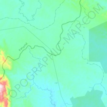
Name: Agua Fría topographic map, elevation, terrain.
Location: Agua Fría, Distrito Santa Fe, Darién, Panamá (8.75279 -78.33105 8.99305 -78.07677)
Average elevation: 110 m
Minimum elevation: 28 m
Maximum elevation: 823 m
Other topographic maps
Click on a map to view its topography, its elevation and its terrain.