
Silvretta topographic map
Interactive map
Click on the map to display elevation.
About this map
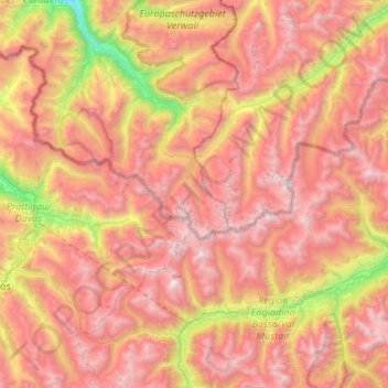
Name: Silvretta topographic map, elevation, terrain.
Location: Silvretta, Gaschurn, Bludenz, Vorarlberg, Autriche (46.74154 9.85374 47.02542 10.38484)
Average elevation: 2,173 m
Minimum elevation: 699 m
Maximum elevation: 3,365 m