
Viso topographic map
Interactive map
Click on the map to display elevation.
About this map
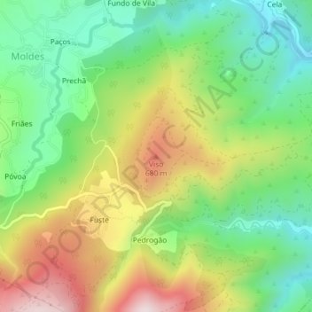
Name: Viso topographic map, elevation, terrain.
Location: Viso, Arouca, Aveiro, 4540-105, Portugal (40.90624 -8.21163 40.90634 -8.21153)
Average elevation: 472 m
Minimum elevation: 251 m
Maximum elevation: 799 m
Other topographic maps
Click on a map to view its topography, its elevation and its terrain.