
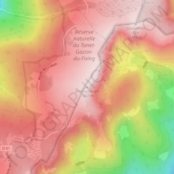
Ringbuhlkopf topographic map
Interactive map
Click on the map to display elevation.
About this map
Name: Ringbuhlkopf topographic map, elevation, terrain.
Average elevation: 1,144 m
Minimum elevation: 808 m
Maximum elevation: 1,299 m
Other topographic maps
Click on a map to view its topography, its elevation and its terrain.
Le Tanet
France > Grand Est > Soultzeren
Le Tanet, Soultzeren, Colmar-Ribeauvillé, Haut-Rhin, Grand Est, France métropolitaine, 68140, France
Average elevation: 1,125 m
Altenkraehkopf
France > Grand Est > Soultzeren
Altenkraehkopf, Soultzeren, Colmar-Ribeauvillé, Haut-Rhin, Grand Est, France métropolitaine, 68140, France
Average elevation: 1,124 m
Ringbuhl
France > Grand Est > Soultzeren
Ringbuhl, Soultzeren, Colmar-Ribeauvillé, Haut-Rhin, Grand Est, France métropolitaine, 68140, France
Average elevation: 1,140 m