
Wolfberg topographic map
Click on the map to display elevation.
About this map
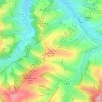
Name: Wolfberg topographic map, elevation, terrain.
Location: Wolfberg, Sonnenstein, Landkreis Eichsfeld, Thuringia, Germany (51.53940 10.37146 51.53950 10.37156)
Average elevation: 240 m
Minimum elevation: 180 m
Maximum elevation: 328 m