
Fafe topographic map
Interactive map
Click on the map to display elevation.
About this map
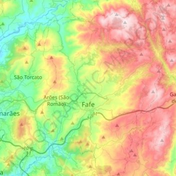
Name: Fafe topographic map, elevation, terrain.
Location: Fafe, Braga, Nord, Portugal (41.37283 -8.24796 41.56595 -8.05519)
Average elevation: 450 m
Minimum elevation: 122 m
Maximum elevation: 885 m