
Gera topographic map
Interactive map
Click on the map to display elevation.
About this map
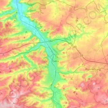
Name: Gera topographic map, elevation, terrain.
Location: Gera, Turingia, Alemania (50.79862 11.99816 50.97659 12.16952)
Average elevation: 278 m
Minimum elevation: 171 m
Maximum elevation: 389 m
Other topographic maps
Click on a map to view its topography, its elevation and its terrain.
Bad Langensalza
Alemania > Turingia > Bad Langensalza
Bad Langensalza, Unstrut-Hainich-Kreis, Turingia, 99947, Alemania
Average elevation: 242 m