
Thank you for supporting this site ❤️
Make a donation
Make a donation
Lousada topographic map
Click on the map to display elevation.
Thank you for supporting this site ❤️
Make a donation
Make a donation
About this map
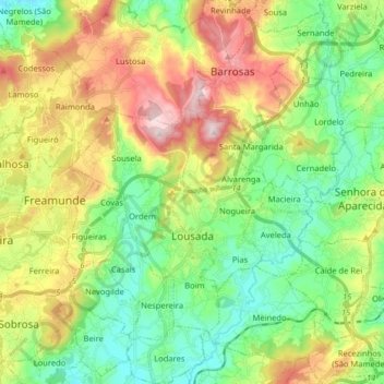
Name: Lousada topographic map, elevation, terrain.
Location: Lousada, Porto, Portugal (41.23081 -8.33975 41.35126 -8.19151)
Average elevation: 301 m
Minimum elevation: 144 m
Maximum elevation: 572 m
Thank you for supporting this site ❤️
Make a donation
Make a donation
Other topographic maps
Click on a map to view its topography, its elevation and its terrain.