
Wislikofen topographic map
Interactive map
Click on the map to display elevation.
About this map
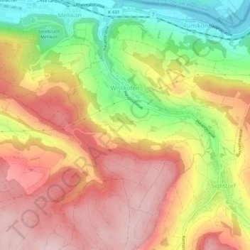
Name: Wislikofen topographic map, elevation, terrain.
Location: Wislikofen, Bezirk Zurzach, Argovie, 5463, Suisse (47.54219 8.34470 47.56399 8.39202)
Average elevation: 482 m
Minimum elevation: 329 m
Maximum elevation: 600 m