
Fiss topographic map
Interactive map
Click on the map to display elevation.
About this map
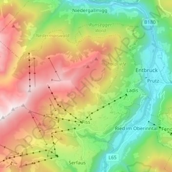
Name: Fiss topographic map, elevation, terrain.
Location: Fiss, Landeck, Tyrol, 6533, Austria (47.04717 10.52583 47.10162 10.64791)
Average elevation: 1,579 m
Minimum elevation: 827 m
Maximum elevation: 2,675 m