
Thank you for supporting this site ❤️
Make a donation
Make a donation
Telok topographic map
Click on the map to display elevation.
Thank you for supporting this site ❤️
Make a donation
Make a donation
About this map
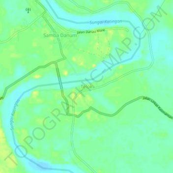
Name: Telok topographic map, elevation, terrain.
Location: Telok, Katingan, Central Kalimantan, Kalimantan, Indonesia (-1.49128 113.08796 -1.45128 113.12796)
Average elevation: 33 m
Minimum elevation: 24 m
Maximum elevation: 44 m
Thank you for supporting this site ❤️
Make a donation
Make a donation
Other topographic maps
Click on a map to view its topography, its elevation and its terrain.
Bukit Baka Bukit Raya National Park
Indonesia > Central Kalimantan > Katingan
Average elevation: 307 m