
Lousa topographic map
Interactive map
Click on the map to display elevation.
About this map
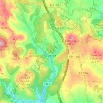
Name: Lousa topographic map, elevation, terrain.
Location: Lousa, Loures, Lisbonne, 2665-535, Portugal (38.86663 -9.23476 38.91679 -9.18480)
Average elevation: 247 m
Minimum elevation: 103 m
Maximum elevation: 427 m
Other topographic maps
Click on a map to view its topography, its elevation and its terrain.