
Schwebsange topographic map
Interactive map
Click on the map to display elevation.
About this map
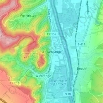
Name: Schwebsange topographic map, elevation, terrain.
Location: Schwebsange, Canton Remich, 5441, Luxembourg (49.49081 6.33619 49.53081 6.37619)
Average elevation: 190 m
Minimum elevation: 136 m
Maximum elevation: 309 m