
Längenfeld topographic map
Interactive map
Click on the map to display elevation.
About this map
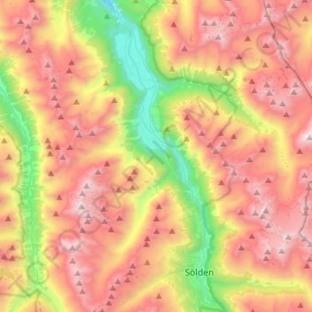
Name: Längenfeld topographic map, elevation, terrain.
Location: Längenfeld, Bezirk Imst, 6444, Autriche (46.94434 10.88542 47.12167 11.11874)
Average elevation: 2,371 m
Minimum elevation: 1,046 m
Maximum elevation: 3,467 m
Other topographic maps
Click on a map to view its topography, its elevation and its terrain.
Klingenburg
Autriche > Bezirk Imst > Oetz
Klingenburg, Oetz, Bezirk Imst, 6433, Autriche
Average elevation: 1,162 m
Holzleiten
Autriche > Bezirk Imst > Obsteig
Holzleiten, Obsteig, Bezirk Imst, 6416, Autriche
Average elevation: 1,262 m
Vent
Autriche > Bezirk Imst > Sölden
Vent, Sölden, Bezirk Imst, Tyrol, 6458, Autriche
Average elevation: 2,371 m