
Thank you for supporting this site ❤️
Make a donation
Make a donation
Graff topographic map
Click on the map to display elevation.
Thank you for supporting this site ❤️
Make a donation
Make a donation
About this map
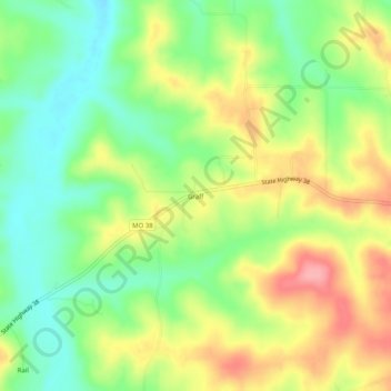
Name: Graff topographic map, elevation, terrain.
Location: Graff, Wright County, Missouri, 65660, United States (37.29755 -92.30266 37.33755 -92.26266)
Average elevation: 394 m
Minimum elevation: 347 m
Maximum elevation: 453 m
Thank you for supporting this site ❤️
Make a donation
Make a donation