
Thank you for supporting this site ❤️
Make a donation
Make a donation
Port Dickson topographic map
Click on the map to display elevation.
Thank you for supporting this site ❤️
Make a donation
Make a donation
About this map
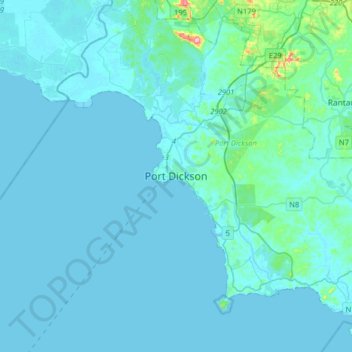
Name: Port Dickson topographic map, elevation, terrain.
Location: Port Dickson, Negeri Sembilan, 71000, Malaysia (2.36289 101.63451 2.68289 101.95451)
Average elevation: 12 m
Minimum elevation: -1 m
Maximum elevation: 240 m
Thank you for supporting this site ❤️
Make a donation
Make a donation