
Malines topographic map
Interactive map
Click on the map to display elevation.
About this map
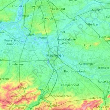
Name: Malines topographic map, elevation, terrain.
Location: Malines, Anvers, Flandre, UNSET, Belgique (50.86814 4.32035 51.18814 4.64035)
Average elevation: 17 m
Minimum elevation: -3 m
Maximum elevation: 97 m
C'est un relief de plaine de faible altitude.