
Thank you for supporting this site ❤️
Make a donation
Make a donation
Longview topographic map
Click on the map to display elevation.
Thank you for supporting this site ❤️
Make a donation
Make a donation
About this map
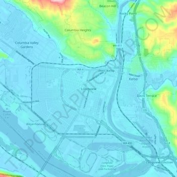
Name: Longview topographic map, elevation, terrain.
Location: Longview, Cowlitz County, Washington, 98626, United States (46.09770 -122.97446 46.17770 -122.89446)
Average elevation: 26 m
Minimum elevation: -5 m
Maximum elevation: 225 m
Thank you for supporting this site ❤️
Make a donation
Make a donation