
Reuler topographic map
Interactive map
Click on the map to display elevation.
About this map
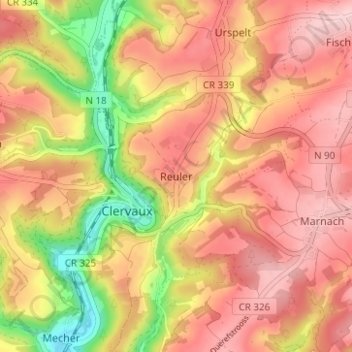
Name: Reuler topographic map, elevation, terrain.
Location: Reuler, Clervaux, Canton Clervaux, 9768, Luxembourg (50.03866 6.01626 50.07866 6.05626)
Average elevation: 456 m
Minimum elevation: 335 m
Maximum elevation: 530 m
Other topographic maps
Click on a map to view its topography, its elevation and its terrain.
Lieler
Luxembourg > Canton Clervaux > Clervaux > Lieler
Lieler, Clervaux, Canton Clervaux, 9972, Luxembourg
Average elevation: 448 m