
Thank you for supporting this site ❤️
Make a donation
Make a donation
Springfield topographic map
Click on the map to display elevation.
Thank you for supporting this site ❤️
Make a donation
Make a donation
About this map
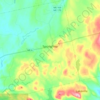
Name: Springfield topographic map, elevation, terrain.
Location: Springfield, Penobscot County, Maine, United States (45.33861 -68.24132 45.44586 -68.09033)
Average elevation: 166 m
Minimum elevation: 94 m
Maximum elevation: 316 m
Thank you for supporting this site ❤️
Make a donation
Make a donation
Other topographic maps
Click on a map to view its topography, its elevation and its terrain.
Thank you for supporting this site ❤️
Make a donation
Make a donation
Thank you for supporting this site ❤️
Make a donation
Make a donation