
Aydın topographic map
Interactive map
Click on the map to display elevation.
About this map
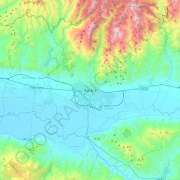
Name: Aydın topographic map, elevation, terrain.
Location: Aydın, Efeler, Aydın, Ege Bölgesi, 09110, Turquie (37.68838 27.68359 38.00838 28.00359)
Average elevation: 363 m
Minimum elevation: 18 m
Maximum elevation: 1,694 m
Other topographic maps
Click on a map to view its topography, its elevation and its terrain.