
万柏林区 topographic map
Interactive map
Click on the map to display elevation.
About this map
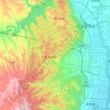
Name: 万柏林区 topographic map, elevation, terrain.
Location: 万柏林区, 太原市, Xanxim, China (37.78120 112.25677 37.98209 112.53694)
Average elevation: 1,121 m
Minimum elevation: 773 m
Maximum elevation: 1,850 m