
Make a donation
Jeffreys Bay topographic map
Click on the map to display elevation.
Make a donation
About this map
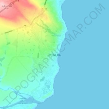
Name: Jeffreys Bay topographic map, elevation, terrain.
Average elevation: 30 m
Minimum elevation: -1 m
Maximum elevation: 176 m
Make a donation
Other topographic maps
Click on a map to view its topography, its elevation and its terrain.
Thyspunt
South Africa > Eastern Cape > Sarah Baartman District Municipality > Kouga Local Municipality
Average elevation: 82 m
Krom River
South Africa > Eastern Cape > Sarah Baartman District Municipality > Kouga Local Municipality > Kromrivier
Average elevation: 43 m
Kouga Dam
South Africa > Eastern Cape > Sarah Baartman District Municipality > Kouga Local Municipality
Average elevation: 275 m
Thyspunt
South Africa > Eastern Cape > Sarah Baartman District Municipality > Kouga Local Municipality > Oyster Bay
Average elevation: 82 m
Make a donation
Thyspunt
South Africa > Eastern Cape > Sarah Baartman District Municipality > Kouga Local Municipality > Oyster Bay
Average elevation: 82 m