
Lake Bangweulu topographic map
Interactive map
Click on the map to display elevation.
About this map
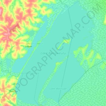
Name: Lake Bangweulu topographic map, elevation, terrain.
Location: Lake Bangweulu, Samfya District, Luapula Province, Zambia (-11.45436 29.56040 -10.84032 30.03397)
Average elevation: 1,172 m
Minimum elevation: 1,160 m
Maximum elevation: 1,240 m
Bangweulu — 'where the water sky meets the sky' — is one of the world's great wetland systems, comprising Lake Bangweulu, the Bangweulu Swamps and the Bangweulu Flats or floodplain. Situated in the upper Congo River basin in Zambia, the Bangweulu system covers an almost completely flat area roughly the size of Connecticut or East Anglia, at an elevation of 1,140 m straddling Zambia's Luapula Province and Northern Province. It is crucial to the economy and biodiversity of northern Zambia, and to the birdlife of a much larger region, and faces environmental stress and conservation issues.
Other topographic maps
Click on a map to view its topography, its elevation and its terrain.