
Hook topographic map
Interactive map
Click on the map to display elevation.
About this map
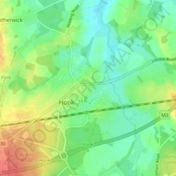
Name: Hook topographic map, elevation, terrain.
Location: Hook, Hart, Hampshire, South East, England, United Kingdom (51.26759 -0.98418 51.30492 -0.92197)
Average elevation: 77 m
Minimum elevation: 56 m
Maximum elevation: 111 m
Other topographic maps
Click on a map to view its topography, its elevation and its terrain.
Odiham
United Kingdom > England > Hart
Odiham, Hart, Hampshire, South East, England, United Kingdom
Average elevation: 98 m