
Thank you for supporting this site ❤️
Make a donation
Make a donation
Mothadaka topographic map
Click on the map to display elevation.
Thank you for supporting this site ❤️
Make a donation
Make a donation
About this map
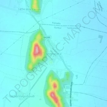
Name: Mothadaka topographic map, elevation, terrain.
Location: Mothadaka, Tadikonda, Guntur, Andhra Pradesh, India (16.45010 80.38295 16.49010 80.42295)
Average elevation: 53 m
Minimum elevation: 31 m
Maximum elevation: 237 m
Thank you for supporting this site ❤️
Make a donation
Make a donation