
Place Raoul de Godewarsvelde topographic map
Interactive map
Click on the map to display elevation.
About this map
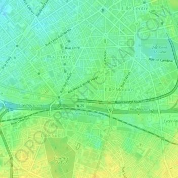
Name: Place Raoul de Godewarsvelde topographic map, elevation, terrain.
Average elevation: 32 m
Minimum elevation: 21 m
Maximum elevation: 43 m
Other topographic maps
Click on a map to view its topography, its elevation and its terrain.
Hellemmes
France > Hauts-de-France > Nord > Lille
Hellemmes, Lille, Nord, Hauts-de-France, France métropolitaine, 59260, France
Average elevation: 33 m
Lille
France > Hauts-de-France > Nord > Lille
Lille, Nord, Hauts-de-France, France métropolitaine, 59800, France
Average elevation: 32 m
Vieux-Lille
France > Hauts-de-France > Nord > Lille
Vieux-Lille, Lille, Nord, Hauts-de-France, France métropolitaine, 59043, France
Average elevation: 27 m