
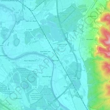
Karlstein am Main topographic map
Interactive map
Click on the map to display elevation.
About this map
Name: Karlstein am Main topographic map, elevation, terrain.
Average elevation: 133 m
Minimum elevation: 99 m
Maximum elevation: 359 m
Other topographic maps
Click on a map to view its topography, its elevation and its terrain.
Schöllkrippen
Allemagne > Bavière > Landkreis Aschaffenburg
Schöllkrippen, Landkreis Aschaffenburg, Bavière, 63825, Allemagne
Average elevation: 279 m
Goldbach
Allemagne > Bavière > Landkreis Aschaffenburg
Goldbach, Landkreis Aschaffenburg, Bavière, 63773, Allemagne
Average elevation: 198 m
Wenigumstadt
Allemagne > Bavière > Landkreis Aschaffenburg
Wenigumstadt, Großostheim, Landkreis Aschaffenburg, Bavière, Allemagne
Average elevation: 203 m