

Make a donation
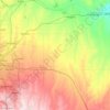
Towaoc topographic map
Click on the map to display elevation.
Make a donation
About this map

Name: Towaoc topographic map, elevation, terrain.
Location: Towaoc, Colorado, United States (37.18402 -108.74052 37.23846 -108.70181)
Average elevation: 1,819 m
Minimum elevation: 1,686 m
Maximum elevation: 2,057 m
Make a donation
Other topographic maps
Click on a map to view its topography, its elevation and its terrain.
Colorado Springs
United States > Colorado > El Paso County
At 6,035 feet (1,839 m) the city stands over 1 mile (1.6 km) above sea level. Colorado Springs is near the base of Pikes Peak, which rises 14,115 feet (4,302.31 m) above sea level on the eastern edge of the Southern Rocky Mountains. The city is the largest city north of Mexico above 6000 feet in elevation.
Average elevation: 2,252 m
Colorado Springs
United States > Colorado > El Paso County
Colorado Springs boasts a diverse and striking topography characterized by its high elevation and mountainous terrain. Nestled at approximately 6,035 feet (1,839 meters) above sea level, the city is flanked by the majestic Pikes Peak, which rises dramatically to 14,115 feet (4,302 meters), forming part of the…
Average elevation: 2,252 m
Denver
Denver is characterized by its diverse topography that combines both high plains and mountain ranges. The city itself sits at an elevation of 5,280 feet (1,609 meters), marking it as the "Mile High City." To the east, the landscape transitions into the High Plains, which extend toward the Kansas border,…
Average elevation: 1,684 m
Durango
United States > Colorado > La Plata County
Durango is set within a striking and diverse topography characterized by its elevation of 6,512 feet above sea level and its position in the Animas River Valley. The city lies at the foothills of the rugged La Plata Mountains to the west and is flanked by the San Juan Mountains to the north and east. This…
Average elevation: 2,162 m
Make a donation
Fort Collins
United States > Colorado > Larimer County
Fort Collins is situated at an elevation of approximately 5,003 feet (1,524 meters) above sea level, nestled at the base of the Rocky Mountains in northern Colorado. The city features a varied topography characterized by gently rolling plains that gradually rise to foothills, creating a picturesque backdrop.…
Average elevation: 1,548 m
Rocky Mountain National Park
United States > Colorado > Larimer County
Rocky Mountain National Park is one of the highest national parks in the nation, with elevations from 7,860 to 14,259 feet (2,396 to 4,346 m), the highest point of which is Longs Peak. Trail Ridge Road is the highest paved through-road in the country, with a peak elevation of 12,183 feet (3,713 m). Sixty…
Average elevation: 3,073 m
Boulder County
Rocky Mountain National Park is in Boulder County, Larimer County, and Grand County. Longs Peak, the park's highest summit at 4,345 meters (14,255 feet) elevation, is located in Boulder County.
Average elevation: 2,308 m
Make a donation
Boulder
United States > Colorado > Boulder County
Boulder is located at the base of the foothills of the Rocky Mountains, at an elevation of 5,430 feet (1,655 m) above sea level. Boulder is 25 miles (40 km) northwest of the Colorado state capital of Denver. It is home of the main campus of the University of Colorado, the state's largest university.
Average elevation: 1,800 m
Lake County
Lake County is a county located in the U.S. state of Colorado. As of the 2020 census, the population was 7,436. The county seat and the only municipality in the county is Leadville. The highest natural point in Colorado and the entire Rocky Mountains is the summit of Mount Elbert in Lake County at 14,440 feet…
Average elevation: 3,398 m
Make a donation
Fort Morgan
United States > Colorado > Morgan County
Fort Morgan is located at 40°15′12″N 103°47′57″W / 40.25333°N 103.79917°W / 40.25333; -103.79917 in Morgan County, Colorado at an elevation of 4,324 feet (1,318 m).
Average elevation: 1,315 m
Make a donation

Ouray County
Ouray County /ˈjʊəreɪ/ is a county located in the U.S. state of Colorado. As of the 2020 census, the population was 4,874. The county seat is Ouray. Because of its rugged mountain topography, Ouray County is also known as the Switzerland of America.
Average elevation: 2,942 m
Aspen
United States > Colorado > Pitkin County
Aspen is a home rule municipality that is the county seat and the most populous municipality of Pitkin County, Colorado, United States. The city population was 7,004 at the 2020 United States Census. Aspen is in a remote area of the Rocky Mountains' Sawatch Range and Elk Mountains, along the Roaring Fork River…
Average elevation: 2,568 m
Make a donation
Gunnison County
Gunnison County is a county located in the U.S. state of Colorado. As of the 2020 census, the population was 16,918. The county seat is Gunnison. The county was named for John W. Gunnison, a United States Army officer and captain in the Army Topographical Engineers, who surveyed for the transcontinental…
Average elevation: 2,892 m
Black Canyon of the Gunnison National Park
United States > Colorado > Montrose County
Average elevation: 2,225 m
Make a donation

Castle Rock
United States > Colorado > Douglas County
Castle Rock is located at 39°22′20″N 104°51′22″W / 39.37222°N 104.85611°W / 39.37222; -104.85611 (39.372212, −104.856090) at an elevation of 6,224 feet (1,897 m). Castle Rock is in central Colorado at the junction of Interstate 25 and State Highway 86, 28 mi (45 km) south of downtown…
Average elevation: 1,952 m
Make a donation
Trinidad
United States > Colorado > Las Animas County
Trinidad is situated in the Purgatoire River valley in far southern Colorado at an elevation of 6,025 ft (1,836 m). The city lies 13 mi north of the New Mexico border. On the northern end of the town is Simpson's Rest, a prominent bluff named for early resident George Simpson, who is buried atop it. North…
Average elevation: 1,907 m
Woodland Park
United States > Colorado > Teller County
The area is characterized by the abundance of large granite rocks and alpine meadows, as well as its consistently high elevation ranging between 8,200 and 10,000 feet above sea level. The climate is considered arid which causes the surrounding forests to become very dry, posing a significant fire threat in…
Average elevation: 2,652 m
Custer County
The county is very rugged and would be virtually inaccessible without roads. The lowest point of the county is around 6,000 feet (1,800 m) in elevation, but most of the county is rugged and mountainous. The county seat of Westcliffe is about 7,800 feet (2,400 m) and along with nearby town Silver Cliff lies in…
Average elevation: 2,616 m
Make a donation

Great Sand Dunes National Park
United States > Colorado > Saguache County
In 1848, John C. Frémont was hired to find a railroad route from St. Louis to California. He crossed the Sangre de Cristos into the San Luis Valley in winter, courting disaster but proving that a winter crossing of this range was possible. He was followed in 1853 by Captain John Gunnison of the Corps of…
Average elevation: 2,616 m
Aurora
United States > Colorado > Adams County
Aurora's official elevation, posted on signs at the city limits, is 5,471 feet (1,668 m). However, the city spans a difference in elevation of nearly 1,000 feet (300 m). The lowest elevation of 5,285 feet (1,611 m) is found at the point where Sand Creek crosses the city limit in the northwest corner of the…
Average elevation: 1,691 m
Make a donation
Littleton
United States > Colorado > Arapahoe County
Littleton is located at 39°35′59″N 105°0′39″W / 39.59972°N 105.01083°W / 39.59972; -105.01083 (39.599691, −105.010929) at an elevation of 5,351 feet (1,631 m). Located in central Colorado at the junction of U.S. Route 85 and Colorado State Highway 470, the city is 9 miles (14 km) south…
Average elevation: 1,684 m
Eagle County
The highest elevation in the county is the Mount of the Holy Cross which rises to 14,011 feet (4,271 m) above sea level. The lowest elevation is on the Colorado River at 6,128 feet (1,868 m).
Average elevation: 2,769 m
Make a donation
Montezuma County
A large county, roughly 1/3 of its area is tribal land, 1/3 is federal land (administered by the National Park Service, the United States Forest Service and the Bureau of Land Management), and 1/3 private or state/county land. It is also varied topographically, ranging in elevation from about 6,000 feet (1,800…
Average elevation: 2,026 m
Dolores County
Dolores County, like other counties in Colorado along its border with Utah, is split into two geographically distinct regions, and in fact, under normal travel conditions, it is necessary to leave the county to travel between the two regions. The western portion of the county (east of the Dolores River Canyon…
Average elevation: 2,385 m
Make a donation
Denver
Denver is located in the Western United States, in the South Platte River Valley on the western edge of the High Plains just east of the Front Range of the Rocky Mountains. Its downtown district is immediately east of the confluence of Cherry Creek and the South Platte River, approximately 12 mi (19 km) east…
Average elevation: 1,684 m

Make a donation
Greeley
United States > Colorado > Weld County
Greeley experiences a semi-arid climate (Köppen BSk). High temperatures are generally around 90–95 °F (32 °C) in the summer and 40-45 °F (4 °C) in the winter, although significant variation occurs. The hottest days generally occur around the third week of July and the coldest in January. Nighttime lows…
Average elevation: 1,448 m
Make a donation

Make a donation
Summit County
The terrain of the county is mountainous with elevations ranging from 7,957 feet (2,425 m) at Green Mountain Reservoir to 14,270 feet (4,350 m) at Grays Peak. The elevation of the county seat of Breckenridge is 9,602 feet (2,927 m), making it one of the highest cities in the state of Colorado and the United…
Average elevation: 3,222 m
Mount Elbert
United States > Colorado > Lake County
Mount Elbert is composed largely of quartzite. However, the summit ridge consists of metamorphic basement rock, which is Pre-Cambrian in origin and about 1.7 billion years old. There are various igneous intrusions including pegmatite, as well as bands of gneiss and schist. Unlike mountains of similar altitude…
Average elevation: 3,959 m

Make a donation
Allenspark
United States > Colorado > Boulder County > Allenspark
Allenspark is located in northwest Boulder County within Roosevelt National Forest in the Front Range of the Colorado Rockies. The western edge of the community is the boundary of Rocky Mountain National Park. State Highway 7 passes through the community, leading north 15 miles (24 km) to Estes Park and east…
Average elevation: 2,874 m

Make a donation

Meeker
United States > Colorado > Rio Blanco County
According to the United States Census Bureau, the town has a total area of 2.9 square miles (7.5 km2), all of it land. The town is situated on the White River at an elevation of 6,250 feet above sea level.
Average elevation: 2,016 m
Make a donation



Make a donation
San Juan County
San Juan County is a county located in the U.S. state of Colorado. As of the 2020 census, the population was 705, making it the least populous county in Colorado. The county seat and the only incorporated municipality in the county is Silverton. The county name is the Spanish language name for "Saint John",…
Average elevation: 3,477 m

Make a donation

Conejos County
Conejos County is in a broad high mountain valley in South Central Colorado. It has an area of approximately 825,446 acres (3,340 km2) in 1,290 square miles (3,340 km2). Roughly half the area is on the nearly level floor of the valley, where the average elevation is about 7,700 feet (2,350 m). The western half…
Average elevation: 2,699 m
Cortez
United States > Colorado > Montezuma County
Cortez has a dry-summer continental climate (Köppen Dsb), though it borders on a semi-arid climate (BSk) due to low precipitation. The city has hot summer days and cold winter nights, the latter a result of its elevation.
Average elevation: 1,865 m
Make a donation
Buena Vista
United States > Colorado > Chaffee County
Buena Vista is located in central Colorado roughly midway between Salida and Leadville in the Upper Arkansas River Valley at an elevation of 7,965 feet (2,428 m). The area between Buena Vista and Salida is often referred to as the Denver & Rio Grande, South Park & Pacific, and Colorado Midland railroads. Many…
Average elevation: 2,457 m
Parker
United States > Colorado > Douglas County
Parker is located in northeastern Douglas County. Its northernmost border follows the Arapahoe County line, and the city of Aurora touches the town's northeast border. The center of Parker is 23 miles (37 km) southeast of downtown Denver. Castle Rock, the Douglas County seat, is 15 miles (24 km) to the…
Average elevation: 1,845 m
Make a donation

Broomfield
The elevation in Broomfield ranges from 5,096 to 5,856 feet. At the 2020 United States Census, Broomfield had a total area of 21,471 acres (86.890 km2) including 371 acres (1.503 km2) of water. It is the smallest county by area in Colorado and the 5th smallest in the United States. Broomfield is the second…
Average elevation: 1,609 m
Make a donation
Yuma County
The point where the Arikaree River flows out of Yuma County and into Cheyenne County, Kansas is the lowest point in the State of Colorado at 1,010 meters (3,310 feet) elevation. This crossing point is the highest low point of any U.S. state.
Average elevation: 1,208 m
Make a donation

Mount Blue Sky
United States > Colorado > Clear Creek County
The history of the Mount Evans Scenic Byway is part of a larger story of the Denver Mountain Parks system. The City and County of Denver initiated the construction of a series of automobile "scenic loops" to allow Denverites to explore the mountains. One road circuit, Circle G, was to traverse the ridge to…
Average elevation: 4,006 m
Make a donation


Jackson County
Most of Jackson County is a high relatively broad intermontane basin known as North Park, which covers 1,613 square miles (4,180 km2). This basin opens north into Wyoming and is rimmed on the west by the Park Range and Sierra Madre Range, on the south by the Rabbit Ears Range and the Never Summer Mountains,…
Average elevation: 2,751 m

Make a donation