Geolocate

Radstock topographic map

Interactive map

Click on the map to display elevation.

About this map

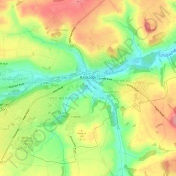
Name: Radstock topographic map, elevation, terrain.

Location: Radstock, Bath and North East Somerset, West of England, England, United Kingdom (51.27374 -2.47654 51.30559 -2.41737)

Average elevation: 117 m

Minimum elevation: 62 m

Maximum elevation: 172 m

Other topographic maps

Click on a map to view its topography, its elevation and its terrain.

Spring Gardens

United Kingdom > England > Bath and North East Somerset > Reading

Spring Gardens, Coley, Reading, Bath and North East Somerset, West of England, England, RG1 6BT, United Kingdom, River Kennet, Kennet and Avon Canal

Average elevation: 47 m

Bath

United Kingdom > England > Bath and North East Somerset > Bath

Bath, Bath and North East Somerset, South West England, England, United Kingdom

Average elevation: 100 m