
Thank you for supporting this site ❤️
Make a donation
Make a donation
Coburn Gore topographic map
Click on the map to display elevation.
Thank you for supporting this site ❤️
Make a donation
Make a donation
About this map
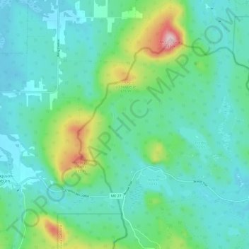
Name: Coburn Gore topographic map, elevation, terrain.
Location: Coburn Gore, Franklin County, Maine, United States (45.37392 -70.82596 45.43123 -70.70704)
Average elevation: 467 m
Minimum elevation: 395 m
Maximum elevation: 744 m
Thank you for supporting this site ❤️
Make a donation
Make a donation
Other topographic maps
Click on a map to view its topography, its elevation and its terrain.