
Zaepert topographic map
Interactive map
Click on the map to display elevation.
About this map
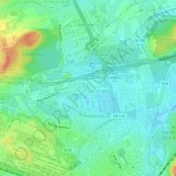
Name: Zaepert topographic map, elevation, terrain.
Location: Zaepert, Esch-sur-Alzette, Canton Esch-sur-Alzette, Luxembourg (49.50565 5.96688 49.51443 5.97974)
Average elevation: 298 m
Minimum elevation: 283 m
Maximum elevation: 335 m
Other topographic maps
Click on a map to view its topography, its elevation and its terrain.
Belval
Belval, Esch-sur-Alzette, Canton Esch-sur-Alzette, 4024, Luxembourg
Average elevation: 307 m