
Sundargarh topographic map
Interactive map
Click on the map to display elevation.
About this map
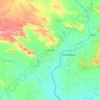
Name: Sundargarh topographic map, elevation, terrain.
Location: Sundargarh, Sundargarh District, Odisha, Índia (22.01659 83.88469 22.25006 84.19029)
Average elevation: 281 m
Minimum elevation: 205 m
Maximum elevation: 515 m
Other topographic maps
Click on a map to view its topography, its elevation and its terrain.