
Thank you for supporting this site ❤️
Make a donation
Make a donation
Bad Saarow topographic map
Click on the map to display elevation.
Thank you for supporting this site ❤️
Make a donation
Make a donation
About this map
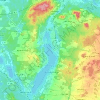
Name: Bad Saarow topographic map, elevation, terrain.
Location: Bad Saarow, Scharmützelsee, Oder-Spree, Brandenburg, Duitsland (52.20332 14.00768 52.32990 14.11748)
Average elevation: 68 m
Minimum elevation: 34 m
Maximum elevation: 148 m
Thank you for supporting this site ❤️
Make a donation
Make a donation