
Thank you for supporting this site ❤️
Make a donation
Make a donation
Harur topographic map
Click on the map to display elevation.
Thank you for supporting this site ❤️
Make a donation
Make a donation
Harur
The town is in northern Tamil Nadu, with an average elevation of 350 meters (1148 feet).
Thank you for supporting this site ❤️
Make a donation
Make a donation
About this map
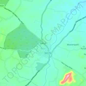
Name: Harur topographic map, elevation, terrain.
Location: Harur, Dharmapuri District, Tamil Nadu, 636803, India (12.01927 78.43808 12.09927 78.51808)
Average elevation: 365 m
Minimum elevation: 321 m
Maximum elevation: 582 m
Thank you for supporting this site ❤️
Make a donation
Make a donation