
Thank you for supporting this site ❤️
Make a donation
Make a donation
Ekshärad topographic map
Click on the map to display elevation.
Thank you for supporting this site ❤️
Make a donation
Make a donation
About this map
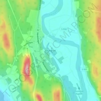
Name: Ekshärad topographic map, elevation, terrain.
Location: Ekshärad, Hagfors kommun, Värmland County, 680 50, Sweden (60.14964 13.48586 60.18964 13.52586)
Average elevation: 174 m
Minimum elevation: 128 m
Maximum elevation: 298 m
Thank you for supporting this site ❤️
Make a donation
Make a donation
Other topographic maps
Click on a map to view its topography, its elevation and its terrain.
Thank you for supporting this site ❤️
Make a donation
Make a donation
Thank you for supporting this site ❤️
Make a donation
Make a donation