
Make a donation
Sterkspruit topographic map
Click on the map to display elevation.
Make a donation
About this map
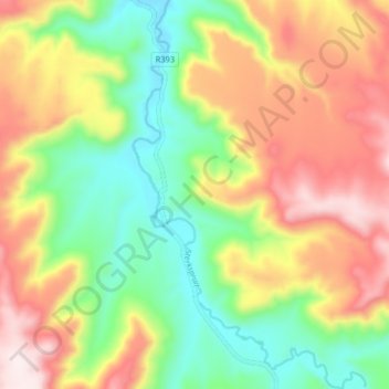
Name: Sterkspruit topographic map, elevation, terrain.
Average elevation: 2,026 m
Minimum elevation: 1,779 m
Maximum elevation: 2,332 m
Make a donation
Other topographic maps
Click on a map to view its topography, its elevation and its terrain.
White City
South Africa > Eastern Cape > Joe Gqabi District Municipality > Senqu Local Municipality
Average elevation: 1,610 m
Lady Grey
South Africa > Eastern Cape > Joe Gqabi District Municipality > Senqu Local Municipality
Average elevation: 1,803 m
Tafelberg
South Africa > Eastern Cape > Joe Gqabi District Municipality > Senqu Local Municipality
Average elevation: 2,138 m
Naledi
South Africa > Eastern Cape > Joe Gqabi District Municipality > Senqu Local Municipality > Naledi
Average elevation: 1,518 m
Make a donation
Fort Hook
South Africa > Eastern Cape > Joe Gqabi District Municipality > Senqu Local Municipality
Average elevation: 1,599 m