
Thank you for supporting this site ❤️
Make a donation
Make a donation
Tingwick topographic map
Click on the map to display elevation.
Thank you for supporting this site ❤️
Make a donation
Make a donation
About this map
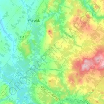
Name: Tingwick topographic map, elevation, terrain.
Location: Tingwick, Arthabaska, Centre-du-Québec, Quebec, Canada (45.79634 -72.02532 45.98261 -71.82771)
Average elevation: 207 m
Minimum elevation: 105 m
Maximum elevation: 473 m
Thank you for supporting this site ❤️
Make a donation
Make a donation