
Río Mamoré topographic map
Interactive map
Click on the map to display elevation.
About this map
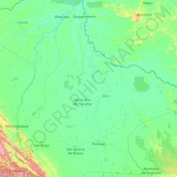
Name: Río Mamoré topographic map, elevation, terrain.
Location: Río Mamoré, Provincia de Mamoré, BNI, Bolivien (-15.94446 -65.43011 -10.38068 -64.72244)
Average elevation: 212 m
Minimum elevation: 107 m
Maximum elevation: 2,414 m
Other topographic maps
Click on a map to view its topography, its elevation and its terrain.