
Laparan Island topographic map
Interactive map
Click on the map to display elevation.
About this map
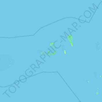
Name: Laparan Island topographic map, elevation, terrain.
Location: Laparan Island, Pangutaran, Sulu, BARMM, Philippines (5.56772 119.66547 6.20772 120.30547)
Average elevation: 0 m
Minimum elevation: -3 m
Maximum elevation: 10 m
Other topographic maps
Click on a map to view its topography, its elevation and its terrain.
Seit Lake
Philippines > Sulu > Old Panamao
Seit Lake, Old Panamao, Sulu, Bangsamoro, Philippines
Average elevation: 14 m
Simisa Island
Philippines > Sulu > Banguingui
Simisa Island, Banguingui, Sulu, Bangsamoro, Philippines
Average elevation: 2 m
Kulassian Island
Philippines > Sulu > Pangutaran
Kulassian Island, Pangutaran, Sulu, Bangsamoro, Philippines
Average elevation: 0 m
North Ubian Island
Philippines > Sulu > Pangutaran
North Ubian Island, Pangutaran, Sulu, Bangsamoro, Philippines
Average elevation: 2 m
Bucutua
Philippines > Sulu > Banguingui > Dungon
Bucutua, Dungon, Banguingui, Sulu, Bangsamoro, Philippines
Average elevation: 14 m
Pangutaran Island
Pangutaran Island, Pangutaran, Sulu, BARMM, Philippines
Average elevation: 2 m
Dammi Island
Dammi Island, Pangutaran, Sulu, Bangsamoro, Philippines
Average elevation: 0 m
Lugus Island
Lugus Island, Lugus, Sulu, Bangsamoro, Philippines
Average elevation: 20 m
Mambahenauhan Island
Mambahenauhan Island, Sulu, BARMM, Philippines
Average elevation: 0 m
Bambannan Island
Bambannan Island, Pangutaran, Sulu, Bangsamoro, Philippines
Average elevation: 0 m
Lapak Island
Lapak Island, Pandami, Sulu, BARMM, Philippines
Average elevation: 34 m
Hadji Panglima Tahil
Hadji Panglima Tahil, Sulu, Bangsamoro, Philippines
Average elevation: 3 m
Manubul Island
Manubul Island, Pandami, Sulu, Bangsamoro Autonomous Region in Muslim Mindanao, Philippines
Average elevation: 0 m
Sibihing Island
Sibihing Island, Siasi Island, Sulu, BARMM, Philippines
Average elevation: 4 m
Pangana Paturuan Island
Pangana Paturuan Island, Siasi Island, Sulu, BARMM, Philippines
Average elevation: 3 m
Tubalubac Island
Tubalubac Island, Pangutaran, Sulu, BARMM, Philippines
Average elevation: 0 m
Tambulian Island
Tambulian Island, Pata, Sulu, BARMM, Philippines
Average elevation: 0 m
Bunotpasil Island
Bunotpasil Island, Banguingui, Sulu, BARMM, Philippines
Average elevation: 1 m
Magados Island
Magados Island, Pangutaran, Sulu, BARMM, Philippines
Average elevation: 0 m
Pandami Island
Pandami Island, Pandami, Sulu, BARMM, Philippines
Average elevation: 4 m
Laminusa Island
Laminusa Island, Siasi Island, Sulu, BARMM, Philippines
Average elevation: 0 m
Dammi Island
Dammi Island, Pangutaran, Sulu, BARMM, Philippines
Average elevation: 0 m
Lumbian Island
Lumbian Island, Pata, Sulu, BARMM, Philippines
Average elevation: 2 m
Simisa Island
Simisa Island, Banguingui, Sulu, BARMM, Philippines
Average elevation: 2 m
West Bolod Island
West Bolod Island, Banguingui, Sulu, BARMM, Philippines
Average elevation: 2 m
Malikut Island
Malikut Island, Pangutaran, Sulu, BARMM, Philippines
Average elevation: 0 m
Simanayo Island
Simanayo Island, Pangutaran, Sulu, BARMM, Philippines
Average elevation: 0 m
Bilangan Island
Bilangan Island, Pangutaran, Sulu, Bangsamoro, Philippines
Average elevation: 0 m
Cabucan Island
Cabucan Island, Hadji Panglima Tahil, Sulu, BARMM, Philippines
Average elevation: 0 m
Tikul Island
Tikul Island, Pangutaran, Sulu, BARMM, Philippines
Average elevation: 1 m
Tubigan Island
Tubigan Island, Pangutaran, Sulu, BARMM, Philippines
Average elevation: 1 m
Lawayan Island
Lawayan Island, Pangutaran, Sulu, BARMM, Philippines
Average elevation: 0 m