
Thank you for supporting this site ❤️
Make a donation
Make a donation
Pebble Township topographic map
Click on the map to display elevation.
Thank you for supporting this site ❤️
Make a donation
Make a donation
About this map
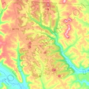
Name: Pebble Township topographic map, elevation, terrain.
Location: Pebble Township, Pike County, Ohio, 45690, United States (39.08382 -83.16857 39.18814 -83.04762)
Average elevation: 276 m
Minimum elevation: 173 m
Maximum elevation: 382 m
Thank you for supporting this site ❤️
Make a donation
Make a donation
Other topographic maps
Click on a map to view its topography, its elevation and its terrain.