St. Veit - San Vito topographic map
Interactive map
Click on the map to display elevation.
About this map
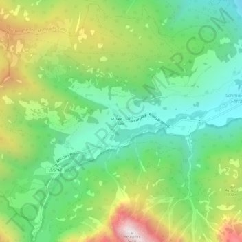
Name: St. Veit - San Vito topographic map, elevation, terrain.
Average elevation: 1,597 m
Minimum elevation: 1,151 m
Maximum elevation: 2,403 m

Click on the map to display elevation.
Name: St. Veit - San Vito topographic map, elevation, terrain.
Average elevation: 1,597 m
Minimum elevation: 1,151 m
Maximum elevation: 2,403 m