
Ridgewood topographic map
Interactive map
Click on the map to display elevation.
About this map
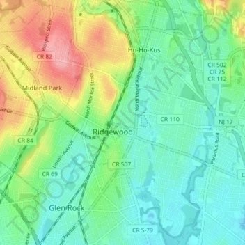
Name: Ridgewood topographic map, elevation, terrain.
Location: Ridgewood, Bergen County, New Jersey, 07450, USA (40.95527 -74.14909 41.00784 -74.07756)
Average elevation: 50 m
Minimum elevation: 15 m
Maximum elevation: 127 m