
Castanheiro topographic map
Interactive map
Click on the map to display elevation.
About this map
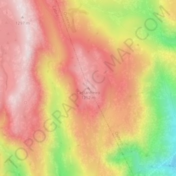
Name: Castanheiro topographic map, elevation, terrain.
Location: Castanheiro, Montalegre, Vila Real, Portugal (41.78797 -8.01606 41.78807 -8.01596)
Average elevation: 1,082 m
Minimum elevation: 747 m
Maximum elevation: 1,283 m
Other topographic maps
Click on a map to view its topography, its elevation and its terrain.
Tourém
Portugal > Vila Real > Montalegre
Tourém, Montalegre, Vila Real, Portugal
Average elevation: 1,026 m
Rio Rabagão
Portugal > Vila Real > Montalegre > Chã
Rio Rabagão, Chã, Montalegre, Vila Real, 5470-071, Portugal
Average elevation: 898 m