
Thank you for supporting this site ❤️
Make a donation
Make a donation
Ramatlabama topographic map
Click on the map to display elevation.
Thank you for supporting this site ❤️
Make a donation
Make a donation
About this map
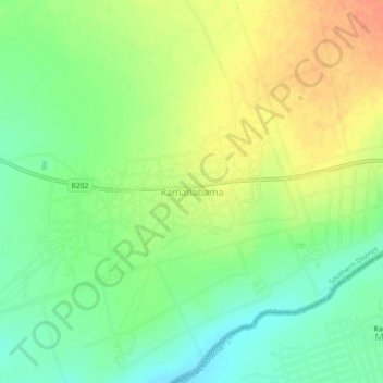
Name: Ramatlabama topographic map, elevation, terrain.
Location: Ramatlabama, Southern District, Botswana (-25.65619 25.53086 -25.61619 25.57086)
Average elevation: 1,279 m
Minimum elevation: 1,259 m
Maximum elevation: 1,300 m
Thank you for supporting this site ❤️
Make a donation
Make a donation