
Kirchberg topographic map
Interactive map
Click on the map to display elevation.
About this map
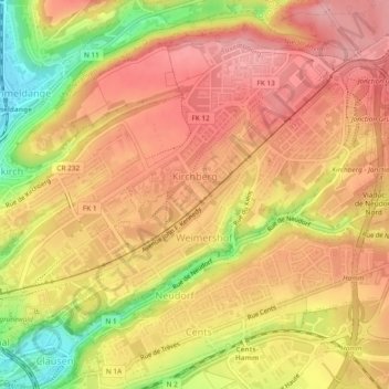
Name: Kirchberg topographic map, elevation, terrain.
Location: Kirchberg, Luxembourg, Canton Luxembourg, Luxembourg (49.61395 6.13267 49.63876 6.17966)
Average elevation: 327 m
Minimum elevation: 237 m
Maximum elevation: 377 m
Other topographic maps
Click on a map to view its topography, its elevation and its terrain.
Allée Léopold Goebel
Luxembourg > Canton Luxembourg > Luxembourg
Allée Léopold Goebel, Belair, Luxembourg, Canton Luxembourg, Luxembourg
Average elevation: 302 m
Limpertsberg
Luxembourg > Canton Luxembourg > Luxembourg
Limpertsberg, Luxembourg, Canton Luxembourg, Luxembourg
Average elevation: 300 m