
Thank you for supporting this site ❤️
Make a donation
Make a donation
Hato Damas topographic map
Click on the map to display elevation.
Thank you for supporting this site ❤️
Make a donation
Make a donation
About this map
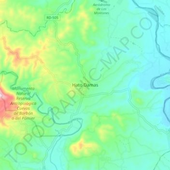
Name: Hato Damas topographic map, elevation, terrain.
Location: Hato Damas, San Cristóbal, 92305, República Dominicana (18.44143 -70.14728 18.52143 -70.06728)
Average elevation: 106 m
Minimum elevation: 10 m
Maximum elevation: 403 m
Thank you for supporting this site ❤️
Make a donation
Make a donation