
Thank you for supporting this site ❤️
Make a donation
Make a donation
Cooperville topographic map
Click on the map to display elevation.
Thank you for supporting this site ❤️
Make a donation
Make a donation
About this map
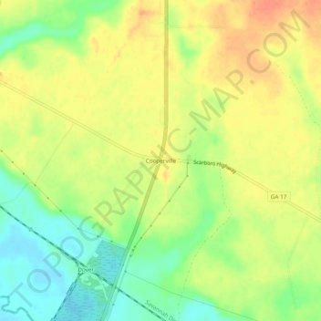
Name: Cooperville topographic map, elevation, terrain.
Location: Cooperville, Screven County, Georgia, United States (32.57073 -81.72400 32.61073 -81.68400)
Average elevation: 47 m
Minimum elevation: 22 m
Maximum elevation: 67 m
Thank you for supporting this site ❤️
Make a donation
Make a donation