
Thank you for supporting this site ❤️
Make a donation
Make a donation
Sanga topographic map
Click on the map to display elevation.
Thank you for supporting this site ❤️
Make a donation
Make a donation
About this map
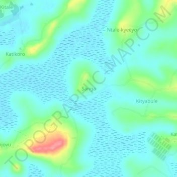
Name: Sanga topographic map, elevation, terrain.
Location: Sanga, Mukono, Central Region, Uganda (0.27367 32.72191 0.31367 32.76191)
Average elevation: 1,154 m
Minimum elevation: 1,136 m
Maximum elevation: 1,222 m
Thank you for supporting this site ❤️
Make a donation
Make a donation