
Aouint Yghomane topographic map
Interactive map
Click on the map to display elevation.
About this map
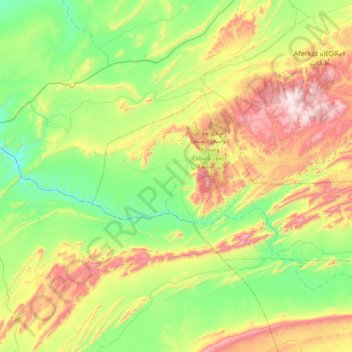
Name: Aouint Yghomane topographic map, elevation, terrain.
Average elevation: 313 m
Minimum elevation: 15 m
Maximum elevation: 950 m
Other topographic maps
Click on a map to view its topography, its elevation and its terrain.
Touizgui
Maroc > Cercle d'Assa > Touizgui
Touizgui, caïdat de Touizgi, Cercle d'Assa, Province Assa-Zag, Guelmim-Oued Noun, Maroc
Average elevation: 348 m